So the long, dreary winter of 2017/18 was finally over. Each day the temperatures nudged up a bit further, the skies cleared and the sun came out. I decided to spend a few days exploring an overlooked corner of southeast England: the vast flat expanses of Romney Marsh. The Ordnance Survey app would be my guide. I booked a hotel room, bought rail tickets, packed my rucksack, and off I went on the 10:43 train from Waterloo East to Folkestone Central.
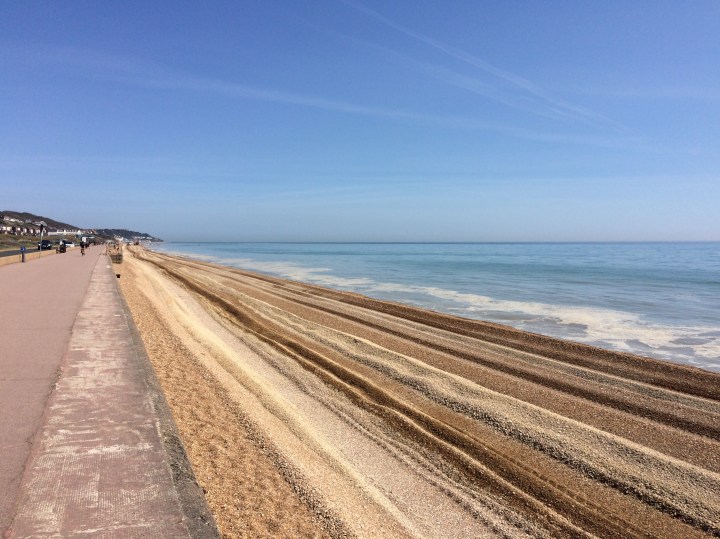
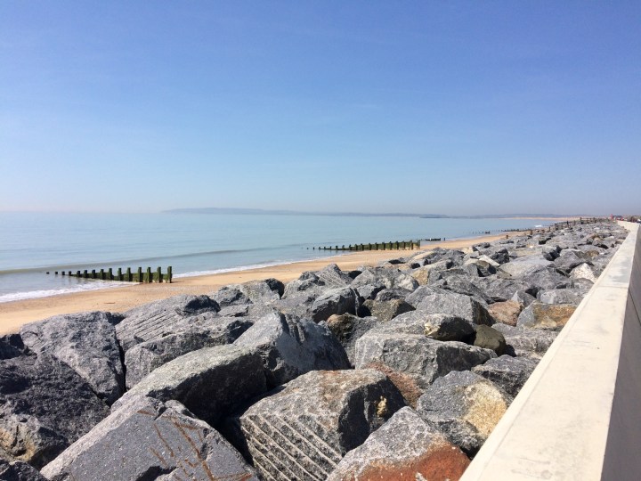
Day 1 was a 19-mile trek from Folkestone to Lydd. For the first half hour the path led westwards high above the English Channel, flanked by green lawns and grand hotels. Then it was down a series of narrow lanes to the sea shore at Sandgate, and straight along the coast to Hythe. The pebble beach was being extensively repaired, presumably after winter storms, and the trucks and bulldozers crawling across it left some pleasing tracks in their wake.
I stopped at a bench and conjured up lunch from the contents of my rucksack. In a thermos flask I had some orange juice with still intact ice cubes – a real treat on what seemed like a hot summer’s day. But it was actually the 18th of April.
Then it was on along the Royal Military Canal, built to protect Britain from the ravages of Napoleon, and past the terminus of the Romney, Hythe & Dymchurch Railway. The toytown trains run down a narrow single track directly behind people’s back gardens, with occasional level crossings giving access to the other side. I had to walk through a rather featureless housing estate and then past a noisy MoD firing range, but the path eventually rejoined the coast – and right in the distance you could see the great hulk of Dungeness power station shimmering through the haze.
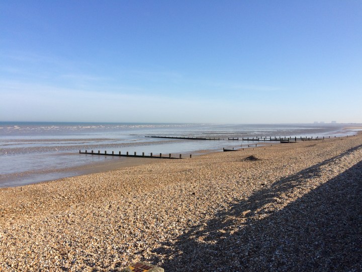
It was a truly glorious afternoon. After stopping for an ice-cold pint of beer in a Dymchurch pub, I walked on past quiet St Mary’s Bay and Littlestone-on-Sea to the even sleepier Greatstone-on-Sea. Along the endless pebble shore I passed rows of brightly coloured beach huts, an all but deserted caravan park and the friendly wilderness of sun-kissed sand dunes. Just a few joggers and dog walkers came the other way.
But after 4 or 5 hours’ walking my feet were starting to feel just a little weary. And when I discovered that the next stretch of route inland led across a mile-long shingle field, the trek turned into veritable torment!
There was worse to come. First there were no more signposts and I had to guess the way across the shingle. Then I found myself squelching along a heavily waterlogged former railway line. And finally, a high fence cut right across my path and I could go no further. It really seemed like the end of the line for me.
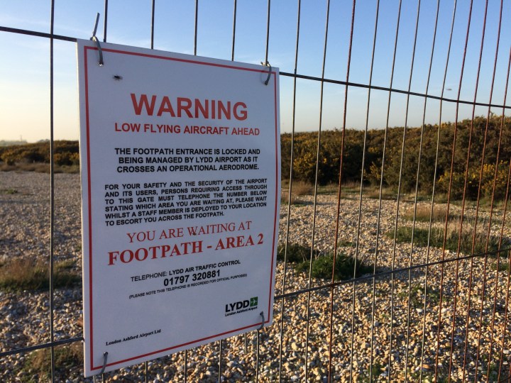
I was less than 2 miles from Lydd, my home for the night, and utterly exhausted. It was 6.30pm. I read the notice pinned to the fence and got out my mobile phone. Just 20% of battery power left… I rang the number with very little hope, but after just a few rings a male voice answered: “Lydd air traffic control.” I almost jumped for joy.
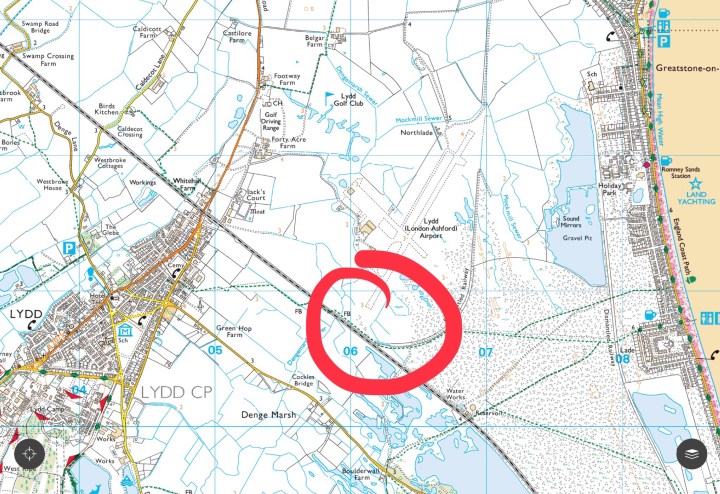
Five minutes later a vehicle appeared and out jumped a young man to escort me around the perimeter of Lydd Airport. Now that’s what I call service. He told me the phones are manned until 7pm each day, so bear that in mind if you are planning an evening walk in the area marked in red on the map below…
I walked on through rapeseed fields into calm, tranquil Lydd, and just after 7pm I checked in to The George, a lovely 17th century inn by the church. After a refreshing shower and a much-needed change of clothing, I went down to the cosy bar and spent the rest of the evening tucking into a hearty beef & Guinness stew and knocking back umpteen beers. Well I deserved them after my 19-mile walk.
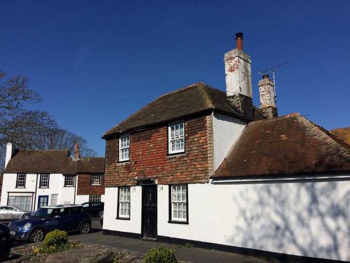
Lydd is almost beyond perfect. The following morning I had a full cooked breakfast and strolled among the pristine houses under bright blue skies. It could not have been a nicer start to the day. There were no emergency service sirens, no drug dealers, no litter, no construction sites, no traffic jams, no chicken nugget cartons… just a quiet idyllic English village (or is it a small town?) and the most ideal weather you could imagine for another day’s hiking.
I was only walking 10 or so miles to Rye on the second day of my trip, and I took things at a somewhat gentler pace. Runkeeper, another trusty app companion, tells me that I averaged 3.48mph on the first day’s 19.4-mile trek, but only 2.96mph on the next day’s 10.2-mile walk. Well my feet were feeling a bit tender by now, and to be honest it wasn’t a race. So I ambled along happily in the sunshine, cross-crossing meadows and trying not to startle the many sheep.
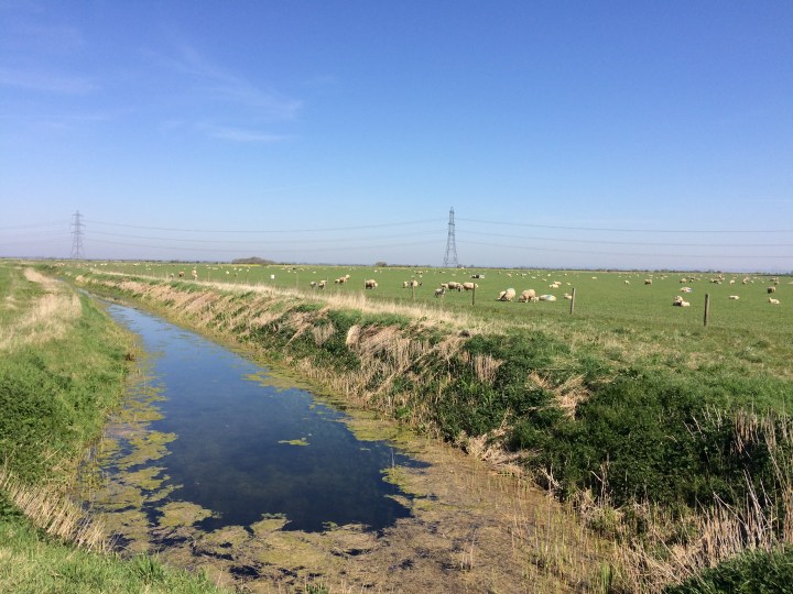
Looking back on the second day’s walk now, what really strikes me is how few people I encountered along the way. The minute I veered off roads and beaches, the paths I followed were almost untrodden. I felt a tremendous sense of privilege to have this glorious rural playground all to myself – but it was also slightly disheartening that nobody else was out enjoying the sheer beauty of the landscape on their doorstep.
At Camber Sands the main beach turned out to be as packed as Benidorm in August, but just a mile or two away peace prevailed. So that’s where I stopped for a rest, lying down and closing my eyes – and opening them just in time to flee the incoming tide. Hard to believe it was mid-April.
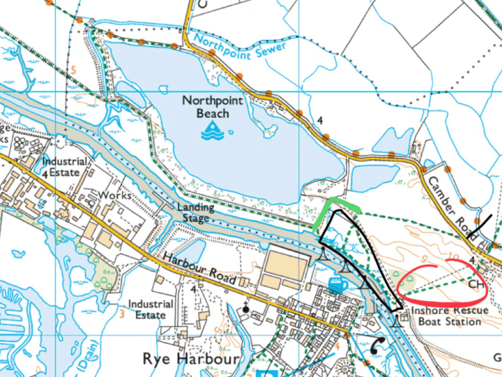
And on to Rye, that little gem of East Sussex – difficult to get to from London, but just a gentle stroll inland from Camber. If anyone’s planning to follow in my footsteps, be aware that some of the paths between the Camber Road and the river are inaccessible – the one marked in red below is open to golf club members only, and those within the black box were all under water when I visited. A permitted detour is marked in light green. I’ve alerted both East Sussex County Council and Ordnance Survey to these issues, so hopefully the maps will be updated in due course. In the meantime, use mine!
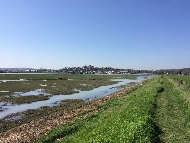
The approach to Rye along the river bank gives you a good sense of the town’s strategic location. Perched on a hillock, its church tower rising above the surrounding marshes, Rye seems like a closely guarded fortress, full of whispered secrets and intrigue.
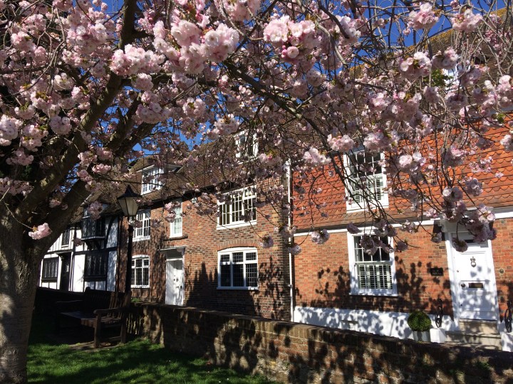
But of course it’s a lovely place. After crossing the road bridge to the other side of the river Rother, a steep lane leads up to the glorious cobbled streets of this charming Cinque port. High up on a terrace, benches provided a welcome spot to get my breath back and take stock of my journey across the marshes. Then I spent some time exploring the magical cottages and alleys of this gemlike town. Rye is truly idyllic, and it seems there’s not a brick or a stone out of place.
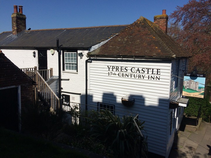
Finally – and only because I deserved it, after 30 miles of glorious walking – I finished my trip at my favourite Rye pub, the Ypres Castle. Next time you’re in the town, pop in and try one of the tasty German beers in a friendly, relaxing atmosphere. The food is good, and there’s live music several evenings a week. I wish it were my local – and maybe one day it will be.